June 19, 2019
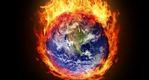
It’s been unusually hot recently in some scorching-hot parts of the world. And it’s been unusually hot in places that aren’t accustomed to being hot at all, especially this time of year.
India last week was in the grip of its worst heat wave, based on how much of the country was affected, according to the National Disaster Management Authority. The capital, Delhi, reached a daily record of 118 degrees Fahrenheit, or 48 degrees Celsius, on June 10.
San Francisco peaked at 100 degrees Fahrenheit on June 12, also a daily record, according to the National Weather Service.
Even Helsinki, Finland, way up north on the Baltic Sea, practically turned into an outdoor sauna when the daily high peaked at 84 degrees Fahrenheit on June 6.
What’s going on?
It’s not yet known whether these individual heat waves are directly linked to climate change. Attribution studies, as they are called, take a while to carry out. But the heat waves are consistent with the overall trend of accelerating global warming. As average temperatures rise because of industrial emissions in the atmosphere, heat records are more frequently broken.
Heat waves are bound to get more frequent and more intense, we reported last summer.
Humanity is no more prepared now than it was then, and the consequences are far-reaching. Sweden and Norway had an unseasonable spate of wildfires in April because of an unusually hot and dry spring. And firefighters in California are bracing for a bad wildfire season, a year after the state’s most disastrous ever.
Heat waves in the Arctic are having another knock-on effect. The ice is thawing — both the vast, mile-thick Greenland ice sheet and sea ice in the Arctic Ocean.
The Greenland ice sheet had a record-setting day on June 12 when melting was seen on more than 45 percent of its surface — about 275,000 square miles. This was the earliest extensive melt “pulse” in four decades of satellite-based measurements. Researchers say a region of high-pressure air stalled over the island, drawing warm air from the south.
The Arctic is warming twice as fast as other parts of the planet, though it is too soon to say how the rest of this melt season will pan out. Cooler weather would slow the melting down.
Sea ice reaches a maximum extent in March and then starts melting, reaching minimum coverage in September. This year, because of the warm conditions, sea ice loss is about three weeks ahead of normal, and on target to reach one of the lowest minimums ever.